From a Windows workstation, click Start  All Programs Accessories Paint.
The image map provides the basis for creating your yard map. Follow these instructions to create and upload the placeholder image map. You must have completed the previous steps in sequence.
Before you begin:
Set up a basic N4 topology
Create a placeholder yard model (on page 1)
Add Bin Name Tables and Bin Names to the placeholder yard model (on page 1)
You must have the Windows workstation Paint accessory.
Be aware that you will use both N4 and Yard Editor to complete this task. Instructions for accessing Yard Editor are included below.
To create a placeholder image map:
From a Windows workstation, click Start All Programs Accessories Paint.
Maximize the Paint window.
Specify 'Pixels' as the resolution Unit:
In Windows XP, open the Attributes dialog (Image Attributes).
In Windows Server 2008 R2, click the file icon  , and select Properties.
For both the width and the height, enter '1000'.
The image of your actual yard should be much higher resolution. The recommended resolution is 1 pixel per 30 cm (1 pixel per foot).
Click OK.
With the rectangle tool, draw an open rectangle using the full width and height of the area. This represents the perimeter of the placeholder yard.
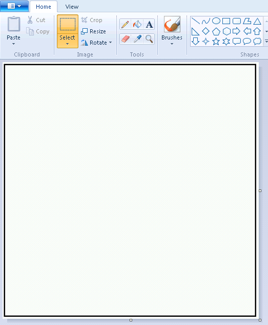
Save the image as a .jpg file.
Upload the placeholder image map:
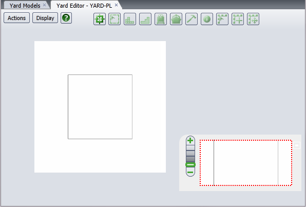
In the N4 Configuration click Models Yard Models Yard Models view.
Right-click the placeholder yard model (YARD-PL) that you created and select Open Yard Editor.
From the window that displays:
Copy the url (such as http://<N4 IP address:port>/apex/yard.zul).
Paste the url into your browser.
Log into Yard Editor using your N4 username and password.
Select Models Yard Models view Actions Open Yard Editor.
The Yard Editor view opens.
Select Actions Import New Map.
In the Image Upload form, click Browse.
In the File Upload form, locate the image file you want to upload and click Open.
The Image Upload form displays the upload progress. When N4 completes the import, the form closes and the map appears in Yard Editor, which now displays  (the Set Reference Point tool).
If the image map does not appear after about 30 seconds, close the Yard Editor tab and reopen it.
Next step(s):
Set Reference Points (on page 1)